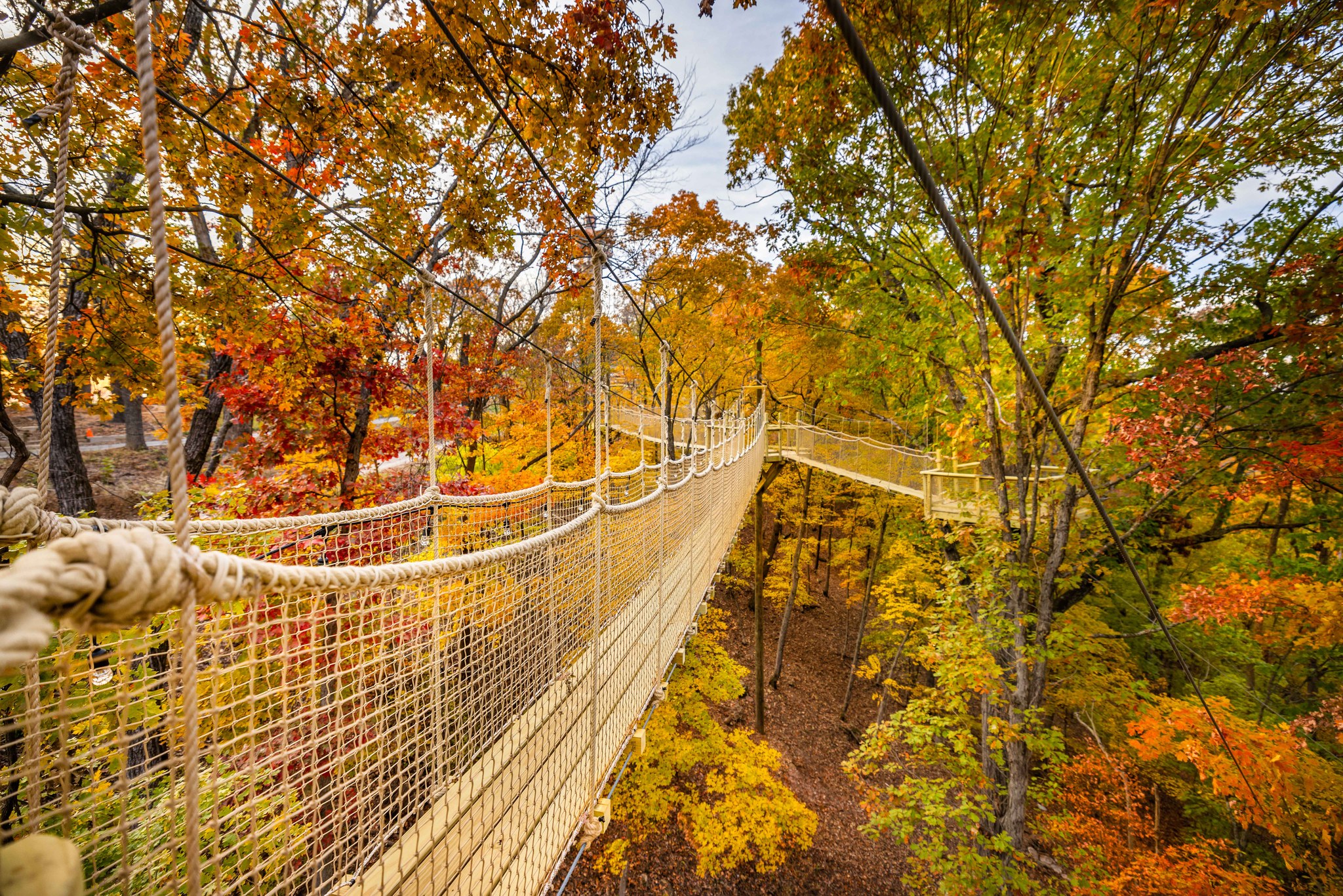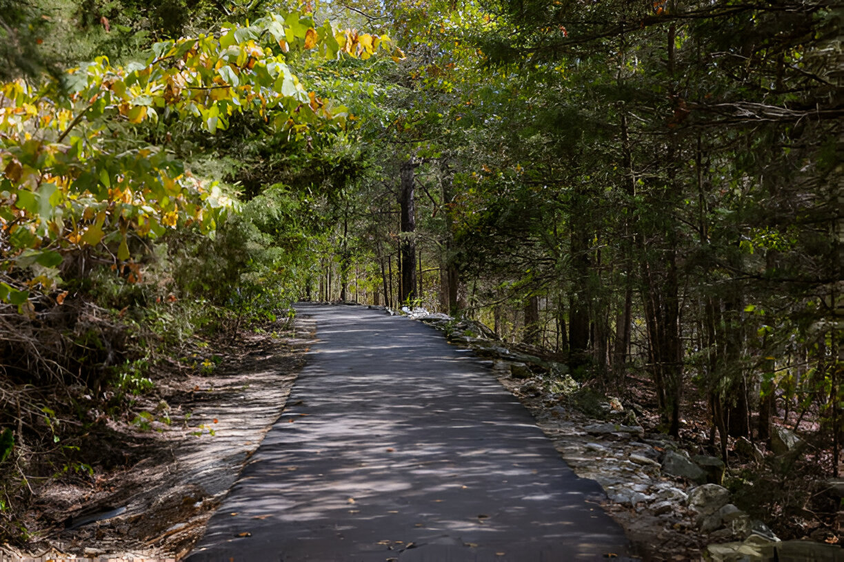



Thousand Hills Vacations manages more than 500 cabins, condos, and lodges near Branson, Missouri, where ten hiking trails circle Table Rock Lake and the Ozark Mountains foothills, from the paved Table Rock Lakeshore Trail to the 10-plus mile White River Valley Trail System. Only Dogwood Canyon charges admission among the ten, and every other trailhead sits within about a 20 minute drive of most Thousand Hills Vacations properties.
Last Updated: July 2026
More than 500 cabins, condos, and lodges sit across Branson, Missouri, and ten of the best hiking trails near Table Rock Lake sit within about a 20 minute drive of nearly every property. Nine of those ten trails charge no admission at all. The paved, wheelchair and stroller accessible Table Rock Lakeshore Trail sits closest to the water, the short Waterfall Trail follows a rocky tributary of Roark Creek to a small falls, and Lakeside Forest Wilderness Area climbs 315 hand-laid stone steps to a wet-weather waterfall and a shallow cave. Only Dogwood Canyon charges admission, and it remains the single paved trail wide enough and flat enough for a full family group pushing a stroller. Guests can browse the full rental lineup on the Thousand Hills Vacations website before choosing which trailhead to visit first.
Table of contents
- What Are the Best Hiking Trails Near Branson, Missouri?
- Is Table Rock Lakeshore Trail Good for Beginners?
- Are There Waterfall Hikes Near Branson, Missouri?
- Are There Easy Hiking Trails Near Branson for Families With Kids?
- Is Dogwood Canyon Worth the Admission Fee?
- Are There Any Other Hiking Trails Near Table Rock Lake?
- What Is the Best Time of Year to Hike Near Branson?
- Are the Hiking Trails Near Branson Dog-Friendly?
- Where Should You Stay After a Day of Hiking Near Branson?
- Frequently Asked Questions
- Can you hike at Table Rock State Park for free?
- How long is the Table Rock Lakeshore Trail?
- What hiking trails near Branson are stroller accessible?
- How far is Busiek State Forest from Branson?
- Are there any hiking trails near Table Rock Lake with lake views?
- Is Henning Conservation Area good for spotting wildflowers?
- Is there a long hiking trail near Table Rock Lake for a full day out?
- Are there any quiet, less crowded hiking trails near Branson?
What Are the Best Hiking Trails Near Branson, Missouri?

Branson’s ten best hiking trails range from a flat 2.2 mile lakeshore path to the 10-plus mile White River Valley Trail System, and nine of the ten charge no admission at all. Each trail sits in or near the Ozark Mountains foothills that ring Table Rock Lake, and none require a permit or reservation to hike. Every one of the ten sits inside a short loop from the Highway 76 corridor, which means a hiker can pick a starting point based on the day’s plans rather than driving across the region first. Families traveling with strollers or wheelchairs tend to start with the paved options, while hikers chasing a longer workout or a waterfall look toward the forest trails further from the lakeshore. None of the ten requires an advance reservation, a permit, or a guided tour, so the only real planning decision is which trailhead matches the day’s energy level and the weather forecast.
| Trail | Distance | Difficulty | Cost | Best For |
|---|---|---|---|---|
| Table Rock Lakeshore Trail | 2.2 mi one-way (4.4 mi round trip) | Easy | Free | Beginners, wheelchairs, strollers, lake views |
| Waterfall Trail | 0.66 to 1.4 mi round trip | Easy to moderate | Free | Short hike, small waterfall, creek crossings |
| Lakeside Forest Wilderness Area | 5.3 mi total (Bluff Trail 1.8 mi) | Moderate to strenuous | Free | Stone steps, cave, wet-weather waterfall |
| Henning Conservation Area | 5.6 mi total | Easy to moderate | Free | Families, spring wildflowers, lookout tower |
| Busiek State Forest | 18+ mi total | Moderate | Free | Longer hikes, mountain biking, horseback riding |
| Dogwood Canyon | 6.2 mi main trail | Easy | $15 to $20 | Paved path, waterfalls, bison and elk |
| Fish Hatchery Trails | 4 connected trails, under 3 mi total | Easy | Free | Short walks, trout viewing, near Table Rock Dam |
| Chinquapin Trail | 1.5 mi one-way (about 3 mi round trip) | Easy | Free | Shaded creek views, connects to Lakeshore Trail |
| White River Valley Trail System | 10+ mi across 4 loop trails | Moderate to strenuous | Free | Longer hikes, mountain biking, bluff views |
| Boston Ferry Trail | About 1 mi out and back | Easy | Free | Quiet, low-traffic walk with river history |
Every trail on this list sits within a half hour of downtown Branson and Highway 76, so a morning hike and an afternoon show along the Strip fit comfortably into the same day.
Is Table Rock Lakeshore Trail Good for Beginners?
Table Rock Lakeshore Trail is one of the most beginner-friendly hikes near Branson, Missouri, thanks to a fully paved, mostly flat 2.2 mile route with only 141 feet of total elevation gain across the entire one-way distance. The trail traces the shoreline of Table Rock Lake near Table Rock Dam closely enough that hikers get water views for most of the walk, a rarity among the region’s trails.
Because the surface is paved and level, the route works for wheelchairs, jogging strollers, and first-time hikers who want a workout without technical footing. AllTrails rates the hike 4.7 out of 5 stars, and hikers who walk the route in winter regularly spot bald eagles and osprey fishing near the dam. Dogs are welcome on a leash, and the paved surface holds up in wet weather far better than any unpaved trail on this list. Guests who book one of the lake condo rentals overlooking Table Rock Lake can often walk to the trailhead directly instead of driving.
At 4.4 miles round trip, the full out-and-back takes most walkers around two hours, though the paved surface means turning back early is simple for anyone hiking with young kids or aging knees.
Many hikers treat the lakeshore path as a warm-up rather than the day’s only activity, walking a mile or two before breakfast and saving the rest of the morning for the lake itself. Because the trailhead sits so close to the dam, the same visit can combine a short hike with a stop to watch the spillway or simply sit lakeside with a coffee. The consistent pavement also means the trail rarely closes for maintenance the way some of the unpaved routes nearby do after a heavy storm, so it tends to be the fallback option whenever the forecast looks unpredictable.
Are There Waterfall Hikes Near Branson, Missouri?
Branson has two hikes that lead to a waterfall: the short, rocky Waterfall Trail off Shepherd of the Hills Expressway and the wet-weather waterfall tucked inside Lakeside Forest Wilderness Area. Both are free, and both depend on recent rainfall for the amount of water actually flowing.
Waterfall Trail runs 0.66 to 1.4 miles round trip near the intersection of Shepherd of the Hills Expressway and Roark Valley Road, following a rocky tributary of Roark Creek to a small falls at the trail’s end. The path is unpaved, rocky, and includes creek crossings, and it turns muddy quickly after rain, so waterproof footwear matters more here than on any other trail nearby.
Lakeside Forest Wilderness Area covers 140 acres inside Branson’s city limits at 412 Owen Lane, and its Bluff Trail climbs about 1.8 miles with 308 feet of elevation gain, rated moderate to strenuous. The route includes 315 hand-laid stone steps, passes the shallow Old Soldier’s Cave, and ends near a waterfall that only runs after wet weather. The trail is not stroller accessible, and the park gates close at 7 p.m. in summer. Old Soldier’s Cave is only a shallow rock overhang rather than a true cave system, so travelers curious about the region’s real caverns can read the guide to Missouri’s most visited show caves for a rainy-day option when creek crossings run too high to cross safely.
Both waterfall hikes reward patience more than distance. A dry week can leave Waterfall Trail’s namesake falls reduced to a trickle, while a few days of steady rain can turn the same creek crossings into a genuine obstacle, so checking recent rainfall before heading out saves a wasted trip. Lakeside Forest Wilderness Area sits close enough to downtown Branson that a morning on the Bluff Trail’s stone steps can be followed easily by lunch back in town, making it one of the easier wilderness hikes to fit around a full day of other plans.
Are There Easy Hiking Trails Near Branson for Families With Kids?
Henning Conservation Area and Table Rock Lakeshore Trail are the two easiest hikes near Branson for families with young kids, both offering flat, well-marked paths under three miles that do not require technical footwear.
- Henning Conservation Area’s Homesteaders Trail covers 3.4 miles with 14 informational stops along the way, making it easy to break the hike into shorter segments with kids.
- The shorter Dewey Bald Trail at Henning Conservation Area runs just 0.4 miles to a 40-foot lookout tower, a manageable distance for younger children.
- Spring hikers at Henning Conservation Area pass blooming dogwood, serviceberry, and redbud along the Homesteaders Trail.
- Leashed dogs are welcome at Henning Conservation Area, and the gate stays open from 8 a.m. to 7:30 p.m. in summer.
- Table Rock Lakeshore Trail’s paved, flat surface works well for families who want a shorter out-and-back rather than a full loop.
- Busiek State Forest’s Purple Trail runs 3.5 miles and suits older kids ready for a moderate multi-use path shared with mountain bikers and horses.
Families staying for a full week often book a multi-bedroom cabin rental so everyone has room to spread out after a morning on the trail.
Is Dogwood Canyon Worth the Admission Fee?
Dogwood Canyon is worth the admission fee for families who want a paved, stroller-friendly trail through 10,000 acres of waterfalls and wildlife, though it remains the only paid hike on this list. The park sits at 2038 W State Highway in Lampe, Missouri, and its main trail runs 6.2 miles on a paved, easy grade.
Admission runs $20 for adults, dropping to $15 Monday through Thursday between 2 and 5 p.m., and the park opens daily from 9 a.m. to 5 p.m. Along the route, hikers pass multiple waterfalls and often spot the park’s bison and elk herds grazing in open meadows, a sight none of the free trails nearby can match. The Monday through Thursday afternoon discount mirrors a wider pattern in the area: Branson’s cheapest time of year to visit consistently lines up with lighter crowds at Dogwood Canyon, not just lower cabin rates.
Are There Any Other Hiking Trails Near Table Rock Lake?
Branson has four additional hiking trails beyond the original six covered above: the short Fish Hatchery Trails near Table Rock Dam, the shaded Chinquapin Trail inside Table Rock State Park, the sprawling White River Valley Trail System, and the historic Boston Ferry Trail north of town. All four are free to hike, and all four welcome leashed dogs.
The Fish Hatchery Trails sit just behind the Shepherd of the Hills Fish Hatchery near Table Rock Dam, where four short paths, the White River Corridor Trail, Canebrake Trail, Fisherman’s Trail, and White River Bluffs Trail, combine for just under three miles. The first three trails run under half a mile each along Lake Taneycomo and offer easy, mostly flat walking, while White River Bluffs Trail climbs a rockier 1.5 to 1.6 mile loop with real elevation gain. The Missouri Department of Conservation maintains the trails free of charge, and leashed dogs are welcome throughout.
Chinquapin Trail runs 1.5 miles one-way through Table Rock State Park on a natural dirt surface marked with green blazes, following the shoreline above Long Creek and the state park marina before connecting into the paved Table Rock Lakeshore Bike Trail. Missouri State Parks charges no entrance fee anywhere on the property, and leashed dogs are permitted on the trail under standard state park pet rules.
White River Valley Trail System is the longest hiking option near Branson, stringing together four color-coded loops, Red, Blue, Orange, and Green, across more than 10 miles of Table Rock State Park and U.S. Army Corps of Engineers land. Limestone bluffs and valley overlooks make the moderate to strenuous route popular with mountain bikers as well as hikers, though sections close temporarily during hunting season and after heavy rain. Leashed dogs are welcome on every loop.
Boston Ferry Trail covers about a mile out and back inside the Missouri Department of Conservation’s Boston Ferry Conservation Area, a quiet stretch of woodland and grassland north of Branson near Lake Taneycomo that traces the route of a 19th century ferry crossing on the White River. The trail stays free and open from 4 a.m. to 10 p.m. daily, and leashed pets are permitted, though hikers should check current archery deer season dates before visiting since bow hunting is allowed on the property.
What Is the Best Time of Year to Hike Near Branson?
Spring and fall offer the most comfortable hiking temperatures near Branson, Missouri, while summer brings the longest daylight hours and winter clears the trails for eagle watching along Table Rock Lake.
- Spring brings wildflower blooms along the Homesteaders Trail at Henning Conservation Area and heavier creek flow at Waterfall Trail, meaning a better chance of actually seeing water at the falls.
- Summer gate hours stretch as late as 7:30 p.m. at Henning Conservation Area, giving hikers extra daylight, though Ozark Mountains humidity makes an early start worthwhile.
- Fall brings the ridgeline color show the region is known for, with the best weeks to catch peak fall foliage color in Branson shifting slightly earlier or later depending on the year.
- Winter thins out trail traffic almost everywhere and is the best season for spotting bald eagles and osprey along Table Rock Lakeshore Trail near Table Rock Dam.
None of the four seasons rules out a hike near Branson entirely, but travelers who plan around shoulder-season weeks in spring and fall tend to get the most comfortable temperatures for climbing sections like the stone steps at Lakeside Forest Wilderness Area or the longer stretches of Busiek State Forest. Summer hikers who start early avoid the worst of the Ozark Mountains humidity, and winter hikers trade color and wildflowers for quieter trails and a better shot at spotting wildlife that stays hidden the rest of the year.
Are the Hiking Trails Near Branson Dog-Friendly?

Nine of Branson’s ten hiking trails welcome leashed dogs, and only Dogwood Canyon restricts pets under its private park rules. Dog owners hiking near Branson tend to plan routes around shade, water access, and trail surface just as much as mileage, since a hot exposed stretch is harder on paws and panting dogs than on the humans holding the leash. The paved trails handle a dog’s nails better than loose gravel or wet rock, and creek crossings on trails like Waterfall Trail give a dog a chance to cool off mid-hike. Checking a park’s specific pet policy before arriving still matters, since posted rules can change by season even at trails that are normally dog-friendly.
| Trail | Dog Policy |
|---|---|
| Table Rock Lakeshore Trail | Leashed dogs welcome |
| Waterfall Trail | Leashed dogs welcome |
| Lakeside Forest Wilderness Area | Leashed dogs welcome |
| Henning Conservation Area | Leashed dogs welcome |
| Busiek State Forest | Leashed dogs welcome, watch for horses and mountain bikes |
| Dogwood Canyon | Not confirmed, check current park rules before bringing a pet |
| Fish Hatchery Trails | Leashed dogs welcome |
| Chinquapin Trail | Leashed dogs welcome |
| White River Valley Trail System | Leashed dogs welcome |
| Boston Ferry Trail | Leashed dogs welcome |
Travelers hiking with a dog for the whole trip usually book one of the pet-friendly cabin rentals close to the free trailheads rather than planning around the one paid park that restricts pets.
Where Should You Stay After a Day of Hiking Near Branson?
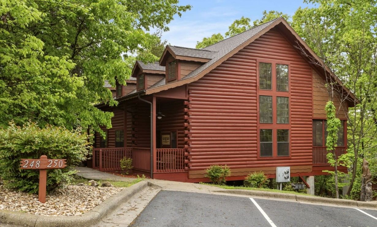
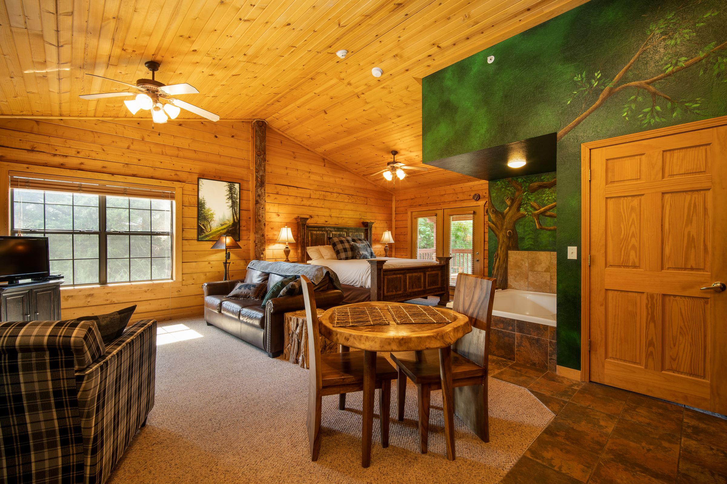
The best place to stay after hiking near Branson is a cabin or condo with a private hot tub and a full kitchen, and Thousand Hills Vacations places most of its inventory within a short drive of all ten trails on this list. Sore legs after the 315 stone steps at Lakeside Forest Wilderness Area or a humid summer stretch of the Homesteaders Trail at Henning Conservation Area are easier to shake off with a hot tub and a home-cooked dinner waiting at the rental instead of a long drive back into town.
Travelers stacking a hike with a Silver Dollar City day or an evening show along Highway 76 can map out the full itinerary using the build my vacation trip planner before booking anything. Families planning an October hiking trip to catch the ridgeline color should check Branson fall cabin availability early, since the same weeks that bring the best hiking weather also bring the highest cabin demand of the year.
A hot tub soak after a hike pairs naturally with a full-kitchen rental, since neither a trailhead breakfast nor a post-hike dinner requires finding a table at a restaurant during the property’s busiest booking weeks. Splitting a longer stay between two or three of the trails on this list, rather than trying to fit all ten into one visit, tends to leave more energy for the shows and attractions along Highway 76.
Frequently Asked Questions
Can you hike at Table Rock State Park for free?
Yes. Nine of the ten hiking trails covered here, including Table Rock Lakeshore Trail, Waterfall Trail, Lakeside Forest Wilderness Area, Henning Conservation Area, Busiek State Forest, the Fish Hatchery Trails, Chinquapin Trail, the White River Valley Trail System, and Boston Ferry Trail, charge no admission fee at all. Only Dogwood Canyon requires a paid ticket.
How long is the Table Rock Lakeshore Trail?
Table Rock Lakeshore Trail runs 2.2 miles one-way, or 4.4 miles round trip, along a paved, mostly flat route near Table Rock Dam with only 141 feet of total elevation gain across its full length.
What hiking trails near Branson are stroller accessible?
Table Rock Lakeshore Trail and the main paved trail at Dogwood Canyon are the two stroller accessible hikes near Branson. Lakeside Forest Wilderness Area’s stone steps and Busiek State Forest’s multi-use terrain are not suitable for strollers.
How far is Busiek State Forest from Branson?
Busiek State Forest sits about 15 to 20 minutes north of Branson off Highway 65, making it one of the closer multi-use trail systems in the area for hikers, mountain bikers, and equestrians alike.
Are there any hiking trails near Table Rock Lake with lake views?
Table Rock Lakeshore Trail offers the most consistent lake views of any hike in the area, tracing the Table Rock Lake shoreline for nearly its entire 2.2 mile route near Table Rock Dam.
Is Henning Conservation Area good for spotting wildflowers?
Yes. Henning Conservation Area’s Homesteaders Trail passes blooming dogwood, serviceberry, and redbud each spring, with 14 informational stops along the 3.4 mile route maintained by the Missouri Department of Conservation.
Is there a long hiking trail near Table Rock Lake for a full day out?
Yes. The White River Valley Trail System links four loop trails across more than 10 miles of Table Rock State Park and U.S. Army Corps of Engineers land, making it the longest hiking option near Branson, Missouri.
Are there any quiet, less crowded hiking trails near Branson?
Boston Ferry Trail offers a quiet, mile-long out and back walk through the Boston Ferry Conservation Area north of Branson, a spot far fewer visitors reach than the trails closer to Table Rock Dam.
Ready to swap trail dust for a hot tub? Thousand Hills Vacations keeps cabins, condos, and lake condos available within a short drive of every trail on this list, from the paved lakeshore path near Table Rock Dam to the paid trail through Dogwood Canyon’s bison herds. Reach out to the reservations team to check availability near whichever trailhead fits the trip.
Written by the Thousand Hills Vacations